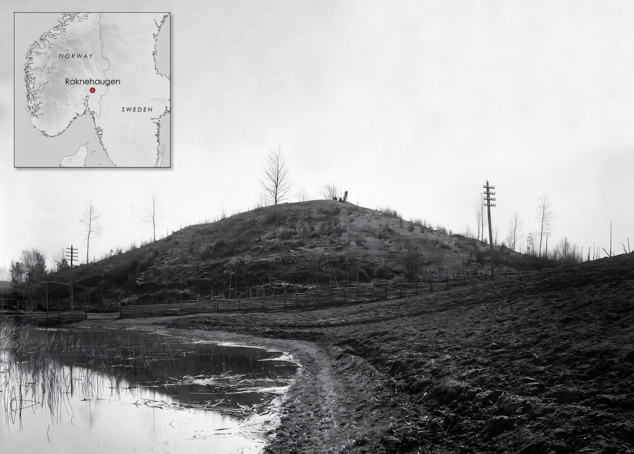
For more than a century, excavations at Raknehaugen have failed to find the burial expected inside Scandinavia’s largest prehistoric mound. A new analysis using LiDAR data instead points to a possible connection with an ancient landslide and suggests the mound may have been built as a ritual response to a catastrophic event.
Raknehaugen stands about 40 kilometers from Oslo and originally measured roughly 15 meters high and 77 meters across. It was first excavated in 1869 and 1870 by antiquarian Anders Lorange, who reached the base without finding a central burial. Excavations led by Sigurd Grieg in 1939 and 1940 also failed to locate one.
The mound’s construction was unusual. It began on an old field with a turf layer, followed by alternating layers of clay and sand. A small burned layer contained fragments of cremated bone. Above it, builders constructed a pyramid from thin, unbarked pine, branches, moss and sandy clay.
More layers of soil and timber followed. The second timber structure used heavier pieces and logs, while the final timber phase contained about 25,000 logs arranged in a tent-like structure and covered with sand and topsoil. The timberwork was described by researcher A. Ording as “unusually ugly.”
Those details have made the traditional interpretation of Raknehaugen as an elite burial increasingly difficult to sustain.
Radiocarbon dating of cremated human remains initially suggested that a person aged 20 to 40 had been placed in the mound. But later dating showed that the person had lived between 1391 and 1130 BC, centuries before Raknehaugen was constructed. The remains were therefore likely deliberately deposited with soil during construction rather than representing the burial of someone from the mound’s own period.
The mound dates to a period of climate disruption
A dendrochronological study of 100 pine trees places construction of Raknehaugen around AD 551. Most of the trees were cut down about 15 years after the Dust Veil Event, a volcanic eruption associated with major climate disruption across the Northern Hemisphere.
Other volcanic eruptions occurred between AD 536 and 660, a period associated in the source material with prolonged cooling, crop failures, famine and population decline.
Dagfin Skre’s earlier radiocarbon work placed construction approximately between AD 536 and 660 and estimated that building the mound would have required about 450 to 600 people, with another 30 to 60 supplying timber.
That timing became important when Lars Gustavsen examined the landscape around the mound.
LiDAR exposed a long, subtle landslide
Gustavsen was studying LiDAR data to examine the mound’s visibility when an unusual feature appeared in one of the landscape visualizations. The scans revealed an ancient landslide measuring approximately 3,800 meters long and 20 meters wide, with a height of about 40 centimeters.
The feature is still somewhat visible in the landscape, but its shallow form makes it difficult to recognize without knowing what to look for. Gustavsen argues that LiDAR made the feature easier to identify and that earlier investigations had concentrated on the inside of the mound rather than its wider landscape setting.
The landslide lies close to Raknehaugen. The mound also sits on a geographical boundary, with glacial sandy ground to the north and richer clay soils to the south and west.
Those observations led Gustavsen to reconsider the mound’s purpose.
“I was never fully satisfied with interpreting the mound as a burial, since the evidence for such an interpretation has always been weak despite several excavations,” he said.
The timber may preserve evidence of a sudden event
The construction timber provides another clue. Some logs appear to have been snapped rather than cut. Others were felled too high for regrowth, while some trees had been pulled up by their roots. Most of the trees were felled during a single year.
Gustavsen argues that these characteristics are consistent with the trees having come from the landslide itself. Under this interpretation, people may have gathered timber affected by the event and used it to construct the mound as a ritual response to the disaster.
The proposed sequence also fits with environmental changes described in the study. As climate conditions deteriorated, the surrounding population shifted from farming toward grazing. That change would have reduced water-absorbing vegetation. Cooler temperatures and heavy rainfall may then have destabilized the clay-rich soils south of Raknehaugen, potentially producing the landslide.
The evidence does not establish that sequence as certain. Instead, the landslide’s location, the mound’s unusual construction, the condition of its timber and the timing of its construction together form the basis for Gustavsen’s interpretation.
A ritual structure rather than an elite tomb
The new interpretation does not rule out burial as something that could occur at a mound. Instead, it challenges the assumption that burial was necessarily its original or primary purpose.
Gustavsen describes Raknehaugen as more consistent with a ritual structure than a high-status burial. He also notes that other Scandinavian mounds lack clear burials, although he considers Raknehaugen unusual.
The study points to examples of large structures associated with responses to disasters, including a mound built by the Nuer people of Sudan after 19th-century outbreaks of smallpox and rinderpest, as well as megalithic monuments in France and Spain associated with local earthquake events.
Gustavsen’s broader interpretation is that shifting attention from mounds primarily as places for the dead toward mounds as ritual structures that could sometimes also contain burials may provide a better way to understand the wider phenomenon.
The study was published in the European Journal of Archaeology.