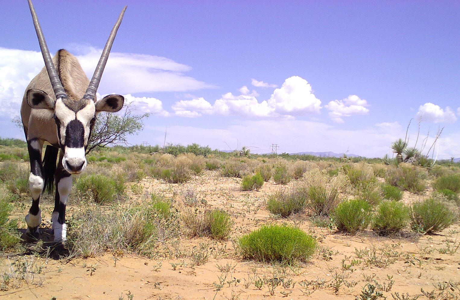
South African Gemsbok already roam the Chihuahuan Desert of New Mexico, more than 100 kilometers beyond the area where they were introduced decades ago. As the climate changes, habitat that currently separates parts of their range could become more suitable, potentially allowing the large antelope to spread farther across the southwestern United States, according to projections from a species distribution modeling study.
Gemsbok (Oryx gazella) are adapted to arid environments, where high temperatures, limited water and seasonal changes in resources can challenge other large grazing mammals. Those adaptations may help the animals persist as the American Southwest becomes hotter and drier. But their future distribution will also depend on factors such as winter temperatures, vegetation, human activity and whether they can move through the landscape between suitable areas.
To examine how those factors might shape the animals’ range, researchers modeled where Gemsbok could find suitable habitat under current conditions and three climate change scenarios extending to the end of the century. Their projections point to a consistent pattern: suitable habitat could become more extensive and more connected, although some areas would remain difficult for the animals to reach or assess reliably.
The findings concern potential habitat, not a confirmed forecast of where Gemsbok populations will establish. The models estimate environmental suitability from recorded occurrences and landscape conditions. They do not demonstrate that the animals will reach every suitable area or that populations will necessarily become established there.
A population established in New Mexico
Gemsbok are native to southern Africa. In the United States, their introduced population began with 95 animals brought to White Sands Missile Range in New Mexico between 1969 and 1977. The animals’ descendants have since established themselves across the Chihuahuan Desert, an arid region extending across parts of the southwestern United States and northern Mexico.
Their distribution has already expanded more than 100 kilometers from the original introduction area. Despite that spread, researchers noted that no Gemsbok records currently document their presence west of the Rio Grande River.
The species has several traits that may help explain its success in the Southwest. Gemsbok can obtain much of their water from the vegetation they eat and have physiological adaptations that limit water loss. They can also adjust their behavior during drought, including reducing daily activity, expanding their home ranges to reach more productive feeding areas and seeking shade.
Their movements may further facilitate expansion. Previous work cited by the researchers indicates that Gemsbok have home ranges of about 3,900 hectares and can travel more than 4 kilometers in a night. They wean their young at around six months of age, when the offspring are approximately half the size of adults.
Predation may provide relatively little control over the introduced population. Mountain lions can kill Gemsbok, particularly young animals, but documented evidence suggests that attacks on adults are uncommon. The researchers therefore considered climate, vegetation, terrain and human activity particularly relevant to understanding where the animals might spread.
The central question was whether the environmental conditions associated with the existing population could help identify additional areas that may become suitable as the climate changes.
Mapping the conditions Gemsbok already occupy
The researchers assembled records of Gemsbok occurrences in the United States from the Global Biodiversity Information Facility, a database of documented species observations. They reviewed the records to remove captive animals and excluded observations with geographic uncertainty of 1 kilometer or more.
The retained records covered 2006 through 2023. Of 112 occurrences initially included, the researchers kept 51 after applying a spatial-thinning procedure. This reduced the clustering of records by retaining observations separated by at least 5 kilometers, helping limit the influence of nearby observations on the models.
They then defined two study regions around the known distribution. One extended approximately 25 kilometers beyond the minimum convex polygon enclosing the occurrence records; the other extended approximately 100 kilometers beyond it. Using two geographic extents allowed the researchers to assess whether their results depended strongly on the size of the region used to train the models.
The environmental data covered several aspects of the landscape. Climatic variables included temperature seasonality, temperature during the coldest quarter, isothermality, precipitation during the wettest quarter and variation in precipitation. The researchers also considered vegetation cover, terrain ruggedness and a human footprint index incorporating factors such as population density, built environments, nighttime lighting, agricultural land and transportation routes.
They used MaxEnt, a modeling method commonly applied to species occurrence records, to estimate the relationship between environmental conditions and habitat suitability. Rather than relying on a single model configuration, they tested different combinations of predictor variables and model complexity, then selected models with strong support under a model-selection criterion.
The resulting models performed consistently across the two study regions. Their area-under-the-curve scores, a measure of how well a model distinguishes recorded occurrence locations from background locations, ranged from approximately 0.76 to 0.80. The models also showed high agreement in their mapped habitat-suitability patterns.
These results indicated that the broad geographic patterns were reasonably consistent across the tested model configurations. They did not establish that every predicted location would support a viable population.
Winter temperatures and seasonal swings stand out
Temperature seasonality and temperature during the coldest quarter were among the strongest predictors of suitable habitat. The human footprint index also contributed substantially to the models.
At the smaller, 25-kilometer extent, temperature seasonality, cold-quarter temperature and human footprint together accounted for approximately 84% of model contributions. At the 100-kilometer extent, temperature seasonality, cold-quarter temperature, isothermality and human footprint accounted for about 80%.
Temperature seasonality describes the degree of variation in temperature over the course of a year. Its strong contribution is notable because the researchers found that Gemsbok habitat suitability was generally higher in areas with greater seasonal temperature variation.
The response curves indicated that suitability was highest when the average temperature of the coldest quarter was between about 5 and 12 degrees Celsius. The authors interpreted cold temperatures as a likely physiological constraint on the species, whereas the hotter and drier conditions of the Southwest may fall within the animals’ tolerance.
The models also associated suitable habitat with a moderate human footprint and relatively low tree cover. Shrub cover had a positive relationship with habitat suitability in both geographic extents.
Some relationships depended on the size of the study region. Precipitation variability was negatively associated with suitability in the smaller region but positively associated with it in the larger one. Terrain ruggedness and isothermality appeared only in the models for the larger region, and their relationships with suitability were not simply linear.
These differences illustrate that habitat associations can depend partly on the geographic area used to build a model. Even so, the overall response patterns were largely consistent between the two extents.
The findings do not mean that human development directly benefits Gemsbok or that temperature seasonality alone determines their distribution. The models identify associations between recorded occurrences and environmental variables, rather than isolating the effects of individual factors through experiments.
Suitable habitat already extends beyond the occupied range
Under contemporary environmental conditions, the models predicted suitable habitat well beyond the Gemsbok population’s current distribution in the Southwest.
Areas of high suitability extended north and south along the eastern side of the Rio Grande and into flat lowlands. The models also identified suitable habitat west of the existing range, including arid areas as far as California.
An eastward corridor of suitable habitat extended from the current range through low-elevation areas. However, the researchers identified a stretch of unsuitable habitat that could restrict access to suitable areas farther east.
The models also indicated a potential westward route along a major roadway through a valley. Yet the lack of recorded Gemsbok west of the Rio Grande suggests that suitable conditions alone do not explain the boundaries of the current distribution.
The researchers proposed that the river, agricultural development along its banks or a major north-to-south interstate could be slowing the animals’ movement westward. The available evidence does not establish which, if any, of these landscape features is responsible. Understanding Gemsbok movement and identifying possible dispersal barriers will require further research.
The two geographic extents produced broadly similar suitability patterns, although the areas of greatest uncertainty differed. Models trained on the smaller extent were more uncertain in the northern portion of the predicted range, while models trained on the larger extent showed greater uncertainty in the east.
This matters when interpreting the maps: the models identify environmental conditions resembling those associated with known Gemsbok occurrences, but they cannot establish that the animals can cross every intervening landscape or occupy every predicted area.
Three climate pathways point toward a more connected range
The researchers projected their models through 2100 using three shared socioeconomic pathways, which represent different possible futures for greenhouse gas emissions and societal development.
The scenarios were SSP1-2.6, representing a lower-emissions pathway; SSP3-7.0, representing a regional-rivalry pathway; and SSP5-8.5, representing a fossil-fueled development pathway. The projections used the GFDL-ESM4.1 climate model and covered three periods: 2011–2040, 2041–2070 and 2071–2100.
Across all three pathways, the models projected increases in both the total area of suitable habitat and its aggregation, meaning that suitable areas were expected to become more connected. The currently occupied areas were projected to remain suitable.
The projections were not identical across scenarios. Under SSP3-7.0 and SSP5-8.5, the models indicated increasing suitability in mountainous areas that could otherwise impede eastward movement. Under SSP1-2.6, the Sacramento Mountains remained unsuitable through 2100, although suitable low-elevation habitat increasingly connected areas east of the current range.
The models also projected increased habitat suitability farther north.
Together, these patterns suggest that climate change could reduce some of the environmental discontinuities separating suitable areas. More connected habitat could make dispersal possible across a broader region, but the maps do not demonstrate that Gemsbok will move through those corridors.
An important qualification is that the researchers updated the climate variables for future projections but kept other environmental predictors, including vegetation cover and the human footprint, at their contemporary values. Reliable projections of those variables were not available for the spatial and temporal scales of the study.
The researchers also restricted projections to areas with sufficiently similar environmental conditions to those represented in the training data. This approach was intended to avoid making predictions in substantially different environments, where model estimates would be more uncertain. As a result, some areas were excluded from future maps even as the remaining modeled regions showed increases in suitable habitat.
The projections therefore describe changes in potential suitability under specified climate scenarios and modeling assumptions, not a complete forecast of future Gemsbok occupancy.
Native wildlife could encounter greater overlap
Gemsbok already share parts of their introduced range with native ungulates, including pronghorn and mule deer. Their diets overlap with those of some native species, although the researchers noted that spatial and dietary overlap with mule deer is limited.
Pronghorn may face particular challenges if environmental changes reduce the resources available to them. Gemsbok can meet their nutritional requirements while feeding on relatively low-quality vegetation and have a flexible diet. Their diets also overlap with pronghorn in the use of key forage species.
The authors raised the possibility that increasing drought and changing conditions could alter interactions between the species. If native populations decline in some areas, Gemsbok might be able to make greater use of habitats and resources that become available. This is a proposed possibility, not an outcome demonstrated by the distribution models.
The study also highlighted potential overlap with American bison. Previous research cited by the authors reported substantial dietary overlap between Gemsbok and bison, with an overlap value of 0.86. Competitive exclusion between the two species has not been observed, however. Greater co-occurrence under future conditions could increase opportunities for competition, but the study did not measure future population interactions.
Disease is another concern. Earlier surveys found that Gemsbok in New Mexico had tested positive for antibodies to malignant catarrhal fever, bovine respiratory syncytial virus, parainfluenza-3 and bluetongue virus. The researchers noted that an expanding range could bring Gemsbok into contact with new wildlife communities and potentially affect the movement of pathogens among ungulates.
The projections do not establish that disease transmission will increase or that native species will experience greater disease burdens. Those outcomes would depend on interactions among species, pathogens and environmental conditions that the habitat models did not assess.
The barriers to expansion remain uncertain
Although the modeled habitat expands under all three climate pathways, the authors emphasized that the actual spread of Gemsbok will depend on more than climatic suitability.
The apparent lack of movement west of the Rio Grande is one unresolved question. Agricultural development and transportation infrastructure along the river may influence dispersal, but the study could not determine whether those features prevent or merely slow movement.
The researchers also noted that the species’ response to temperature seasonality may not represent a true shift in its climatic niche. Gemsbok already encounter seasonal temperature patterns in the Southwest that differ from those in their native range. The authors suggested that cold-quarter temperature may remain the more important physiological limit, while greater seasonality could be associated with suitable habitat without imposing the same constraint.
The study’s projections also depend on the occurrence records, the choice of two buffered study regions, the environmental variables included in the models and the assumptions used for future climate projections. Keeping vegetation and human footprint constant means the models do not capture possible changes in those conditions. Restricting projections to environmentally similar areas also leaves some potential future environments unassessed.
Finally, the authors noted that management decisions cannot be based on ecological projections alone. Previous efforts to manage Gemsbok have faced costs that exceeded the economic benefits from hunting, as well as difficulties associated with public views on lethal control. They argued that effective management planning would require public engagement, outreach and coordination among agencies.
The models provide a consistent projection of expanding and increasingly connected suitable habitat, but the timing, routes and eventual extent of any further spread remain uncertain.
The study was published in Journal of Mammalogy.